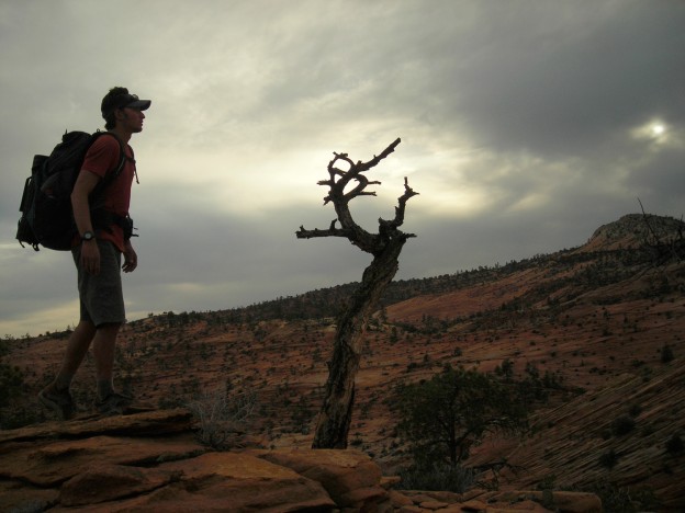
The Hayduke Trail is more or less a backcountry route that uses mainly cross country travel, existing trails, and 4WD roads that starts in Arches National Park and traverses through most of the national parks in Utah and the 4 Corners region before it ends in Zion National Park. This is another fantastic hike with great scenery. The Canyon Country is so different from anywhere else. I highly recommend this hike if you are comfortable with your navigation and map reading skills. Pepper and I completed this hike in the spring of 2008.
We started from Arches on April 1 and finished in Zion on May 6. This was another terrific trip.
View Hayduke Trail in a larger map
Hayduke Trail Logistics
The Hayduke Trail is a wilderness route. It is not a marked trail, nor does it actually follow trail tread for much of its route. You will be required to navigate and be proficient in your map and compass skills. I am currently remapping the trail on the TOPO! software, so if you are interested in hiking the trail and have purchased the UT and AZ programs, then I may be able to send you the route already marked on the maps (when I finish). This will save you some time and effort, but by no means is it the only planning that you need to do. The guidebook does a great job of explaining the route, but this hike is very different from the AT, PCT, or CDT so be prepared.
Getting to the Start/End: It is not very easy to access Arches N.P. or Zion N.P. To get to Moab, you can fly into Grand Junction and take a shuttle to Moab (can be pricey), or fly into St. George or Salt Lake City and take the Greyhound to Green River, UT. From Green River you either have to hire a shuttle (which can be pricey) or hitch-hike. This can be an easy hitch if you look like an outdoorsy person. The actual terminus of the author’s route is on the Salt Valley Road at the park boundary which can also be hard to get to. If you are going to start there then the turn-off to Salt valley Road is a few miles south of the Crescent Junction interstate exit which leads to Moab. Cnahces are that you will not get a ride to the park boundary, which will add about 10–12 miles to the start of the hike. Or you can do what Brian Frankle did and start from Delicate Arch, inside the park boundary, where you will probably be more likely to get a ride.
To get to/from the Weeping Wall in Zion N.P.-There is a free N.P. shuttle that will take you out to Springdale, UT. From there it is probably close to 70 miles to St. George. There is no public transportation that heads that way but it also seems like a fairly easy place to hitch-hike. In St. George there is an airport or you can get the Greyhound at the McDonald’s just off the Bluff St exit off of I‑15 to Las Vegas, Salt Lake City, Denver, or back to Green River.
Another option for the western terminus is to hike to the Kolob Trailhead of Zion N.P. which is just off of I‑15. In order to get to this trailhead from the Weeping Wall terminus, you would continue south on the main park road to the Angel’s Landing Trail. Follow that trail to the West Rim Trail. Continue on the West Rim Trail until you get to a dirt road. Walk the dirt road generally north past Blue Springs Reservoir and Kolob Reservoir. Connecto to the trail that drops you into Willis Creek and follow that into LaVerkin Creek. Continue on this trail, it will leave LaVerkin Canyon and shortly thereafter connect to a road. Follow the road to the Visitor’s Center and I‑15. If you want to continue hiking you can walk all the way to St. George without walking too much on paved roads. From the crossing of I‑15 you can head back up into the Pine Valley Mountain Wilderness on the west side of the interstate. You can follow the Summit Trail or a smattering of trails south and into St. George.
Water
This hike is in the desert, so naturally water will be an issue, or at least on your mind heading into the trip. From my experience the water situation was not bad at all. I think the longest stretch we carried for was 45 miles, but along that stretch we did see some water that we could have drank from if we needed to. There were also a few 30 mile stretches where we also did see water we could have used, not all of it good water, but beggars can’t be choosers. Generally there was more water than we were expecting. It was a wet winter and a cool spring, so I am sure that helped a bit. I never carried more than 3.5 liters and Pepper never carried more than 5 liters. The guidebook was very good at describing the year-round water sources (although sometimes they would be a trickle, at least they were flowing) and we would often come across other sources. Sometimes the sources would be good (water dripping out of a rock face, or a man-made spring house) and other times they would be cattle fouled or stagnant potholes from the last rainstorm. We were doing 25–35 miles per day though so the waterless stretches could be a day or 2 of hiking if your pace is slower. There really is no need to drive around and cache water. The author’s planned the route with water in mind.
Resupply
The Hayduke Trail, being a wilderness route, does not pass through any towns with the exception of Moab at the beginning of the route. The route was designed around remote cache points at section terminals, making traditional “Post Office” resupply a bit more difficult than one might experience on other long distance trails. These are some resupply options that I put together with a thru-hiker’s mindset from our trip experience and some of Brian Frankle’s answers to our questions when we were doing our planning.
Section 1: Continue down Hwy 191 into Moab. Full service resupply. There are convenience stores, grocery stores, motels and a Library with free internet. The Post Office is at 50 E 100 N Moab, UT 84532–9998 (435) 259‑1688 M‑F 8am to 5pm, Sat 9am to 1pm.
Section 3: Canyonlands Needles Outpost, located just outside the entrance to the Needles District of Canyonlands NP. This will be a hitch 5–10 miles down the park road from the Big Spring Trailhead if you stay on the author’s route. If you take the author’s alternate and head up Indian Creek all the way then it might be right on the route (I am not too familiar with this) butthen to keep a continuous walk you would have to roadwalk 5–10 miles back to the author’s route.
Packages can be sent UPS to Canyonlands Needles Outpost Hwy 211 Monticello, UT 84535 (435) 979‑4007. There are also a small convenience store and campground located there.
Section 4: Hite Marina, located just off of Hwy 95. UPS to Hite Store, Hite, UT 84533. USPS to PO Box 501 Hite, UT
84533 (435) 684‑2278, 7 days, CLOSED IN NOVEMBER. The Hite Store is a sparsely stocked convenience store open from 11am to 1pm. It is highly recommended that you send a package instead. It is about 2 miles off the author’s route down the Hite Access Road.
Section 5: Hanksville, UT. It would be about a 17 mile hitch on Hwy 95 to Hanksville to resupply. Full service resupply with convenience stores, a grocery store, motels and restaurants. The Post Office is located at 130 E 100 N Hanksville, UT 84737–8001 (435) 542‑3433 M‑F 8:30am to 1:45pm then 2:45pm to 4:30pm, Sat 9:30am to 12:30pm.
Section 7: Escalante Town. Hitch about 30 miles up the Hole-in-the-rock Road then 6 miles west on Hwy 12 to Escalante. Full service resupply with convenience stores, grocery store, motels and outfitter. To return to the trail, hitch/solicit a ride in front of the outfitters. Most people that stop at the outfitters are headed down the HITR. NPS, BLM, USFS office on west end of town will issue permits. The Post Office is at 230 W Main St. Escalante, UT 84726–800 (435) 826‑4314 M‑F 8:30am to 4pm, Sat 8:30am to 12pm.
Section 9: Tropic, Utah. About 20 mile hike off the author’s route, but a recommended detour because you come into Bryce Canyon N.P. farther north and it is a great hike. Full service resupply with convenience stores, grocery store, restaurant and motel. Great trail town with everything close by. Everything except the restaurant and America’s Best Value Inn is closed on Sundays. The Post Office is at 31 N Hwy 12 tropic, UT 84776–8001 (435) 679‑8743 M‑F 8am to 12pm then 1pm to 5pm, Sat 9am to 12pm.
Section 10: Jacob Lake, AZ. About 2.8 miles off the trail. Small convenience store, restaurant and lodge. Packages can be sent to Jacob Lake Inn, Jacob Lake, Arizona 86022 (928) 643‑7232 CALL FIRST TO HAVE PACKAGE HELD.
Section 12: Grand Canyon Village, South Rim. Full service resupply with grocery store, restaurants and lodging. If you take the author’s route through GCNP then this will not be a typical resupply option because it will add about 20 miles and 4000ft of elevation gain, but there are a lot of alternates possible in GCNP depending on permit availability Free shuttle buses around the rim.
Section 13: North Rim Village. Usually doesn’t open until May 15. Restaurant and lodging. Post office located in the Grand Canyon Lodge complex. Grand Canyon Lodge, General Delivery, North Rim, AZ 86052 M‑F 8am to 4pm Sat
9am to 1pm (928) 638‑2611.
Section 14: Colorado City. Convenience store and grocery store. Post Office located at 55 S Cenral Colorado City, AZ 86021–5000 M‑F 8:30am to 4:30pm, Sat closed (928) 875‑2424.
Section 15: Springdale, Utah.Full service with convenience stores, grocery store, restaurants and lodging located just outside of Zion National Park. The post office is at 624 Zion Park Blvd Springdale, UT 84767–9400 (800) 275‑8777 M‑F 7:30am to 4pm, Sat 9am to 12p
I am not going to re-type the author’s resupply strategy, if you want to see that or use caches then reference the guidebook. They describe their cache strategy and the places they used as resupplies.
Climate on the trail and the seasons to hike:
The trail mainly traverses desert and canyon landscapes, but it does go up over 11,400 feet and stays between 7000–9000 feet for around 50 miles. Typically the weather is dry and sunny. It can snow, thunderstorm, and it is often windy. Early in the season you can hit a fair amount of snowpack in the Henry Mountains and on the Kaibab Plateau. Starting in late winter/spring is ideal, as is the fall. The summer is very hot and you can hit the monsoon thunderstorms which create flash floods. The late winter/spring and fall are good because there should be more water because the groundwater gets rejuvenated from the snowmelt and the monsoons. During both of these hiking times you can encounter stormy weather.